• There has been a recent cluster of spammers accessing BARFer accounts and posting spam. To safeguard your account, please consider changing your password. It would be even better to take the additional step of enabling 2 Factor Authentication (2FA) on your BARF account. Read more here.

Saline Valley Thanksgiving 2013

Thanks everyone, it was getting a little lonely in ride report land :p
 
I always forget to check back in here to see the latest adventures from folks. This is yet another enthralling installment in the adventure that is your life, G. :love
 
Most epic ride report EVAH!!!


Written by the most epic BARFer EVAH!!!


:love
 
Ok back to business :p

With it being Saturday and there is no sign of Bear's U-joints it's time to reassemble his F250 and turn it from 4WD to 2WD. Luckily it's his front drive shaft that is kaput. The road conditions are improving daily every truck that has rolled in has shoveled, or moved rocks, filling in here, clearing there. We got in OK with the dually rear wheel drive and expect Bear to be fine.

Speaking of road conditions...
With nearly everyone gone we thought we should check out the washouts on our bikes.

Of coarse this means another 8 mile jaunt down Bat Rock Road :teeth

We get to the end of the road, make a right and head up to the Willow Springs washout.
It's interesting to view the stages of the washout, the amount of debris deposited on the former road surface before the under-layment collapsed and washed away.

11327249365_024cbd7496_b.jpg

11327866556_35dce63e52_b.jpg


on the other side

11327351264_a4f5462e14_b.jpg


The 4X4 clubs and Inyo County created this bypass which looks pretty innocent in the photos.

11327270465_3b862b812d_b.jpg

11327231535_16764ae79a_b.jpg
 
My bike doesn't have a kickstand so I find a lone creosote bush to lean the beast against while I take a walk through the wash.

11327238586_642728284e_b.jpg


looking up above the bike I can see the former road. This was a violent event.

This video isn't this washout but it gives a little perspective on how these things move.

[youtube]_yCnQuILmsM[/youtube]
 
Adding more Wow's, What a journey of pictures and words :thumbup

And...such a fantastic job was done on the previous Sprinter, by You-pair, it will be done again, on this one :thumbup.

Thanks for doing this report, My vicarious is breathless.
 
I like your style, G. Great writeup and pics! :thumbup
 
Wonderful pictures and story G! I feel like I am right there with you :thumbup
Loved the opening shot of the ATK suspended from the ceiling..."gee, I'm not the only one who hangs my bike upside down to fix it":teeth

The scenery and beauty of the DV area is amazing...I haven't gotten there yet and it's moving rapidly higher on the list :thumbup Loved the pics of just your boots and the empty beautiful landscape behind as you venture off....

Thanks for taking us along on your adventure...still awaiting the next installment...will Bear make it out? Will the sportswagon? ever be found...are those u-joints cursed...looking forward to where ever you take us next :ride


T
 
Each morning we wake up, make coffee (which is difficult as the coffee pot was broken on the first day of the trip :() and head up to the upper spring for a dip.

Usually these pools are a little crowded over Thanksgiving but not this year, Mother Nature culled the population and after Thursday's feast there are very few of us remaining.

11326677686_c87629ded3_b.jpg


The men gather in the Volcano pool as the Bossdog contemplates joining them.

not totally safe for work

From the pool we watch the sunrise and wonder about the Sportsmobile; is he still stuck up there in the snow :dunno

11325653794_be2617b117_b.jpg


Finally, we are able to be still and not worry about the next task.
 
Saline Valley has some of the biggest bluest skies, of all the places I have traveled to, this remains one of my favorites.

11325691926_fd2d8ca4f7_b.jpg


We find ourselves watching the snow melt off the mountains to the North. Only the die hard drifts remain after a week.

11325722286_bd96ffd0b3_b.jpg


The weather has been spectacular but we hear change is coming. We take another ride out to the wash to try and find that perfect rock. A quartz mine washed out, along with a cabin, and I'm hoping to find some quartz crystals.

11327351953_2629dcc5df_b.jpg


The wash is spectacular and reveals layer upon layer of rock deposits.

11327291614_edabdae97f_b.jpg
 
We wake the next morning to some ominous clouds and realize it's time to get out.

11326880733_fc4906c28f_b.jpg


11326824736_2c2fc66abc_b.jpg


11326817636_77edf8a5fc_b.jpg
 
Last edited:
We pack up as the wind begins to build and sand from Eureka Dunes makes its way into Saline Valley.

We say our goodbyes and head out :(

One last stop at the Bat sign to snap a photo and it's as if a cloud of sand is chasing us out of the valley.

11326652794_ceeec45c6e_b.jpg


Unfortunately, we are about an hour too late in our departure and find ourselves driving head on into the storm once we make the turn to leave.

We are forced to take refuge and hide out until the wind calms. The creosote bushes offer some protection but we are concerned about parking in the wash. The wind continues to howl for several hours.

11325804604_64aa0d4af0_b.jpg


Hiding out puts us another couple hours behind and we face the worst washouts at night. In some respects this is a good thing as the Sprinter's headlights illuminate the path, eliminating those surprise hidden rocks that do the most damage. Fortunately, we had placed stakes and surveyor's tape marking the best line going through the difficult terrain on one of our rides. Getting out of the valley is far less problematic than we anticipated.
 
Last edited:
With the sun down and the temperature dropping those ominous clouds are now a menacing threat. With the pass at 7600 feet we know we will see some snow. Luckily this is the first snow following 10 days of warm sunshine and although it sticks there isn't enough yet to be a problem.

Up, up, up we go, climbing through the steep narrows of Franklin Canyon. As we near the top the ratio of ice/snow to solid earth has tipped and the road is getting sketchy.

We take a moment to assess the situation.
The Bossdog can get enough bite into the surface not to slide.

11326583836_26491a43d5_b.jpg


A D7-Dozer and a pair of excavators have gone up the road recently laying down tracks. The tracks have just enough moisture in them to be frozen and serve as a sort of anti-skid. We opt not to install the chains as we have four rear tires and the chains are now held together with seizing wire after our last little event with them.

11326539845_65d0bc80c2_b.jpg


We add our own dually tracks make it over the summit with minimal slipping and sliding and burst out laughing.
 
Last edited:
Now that we are out of the valley it's time to beat feet and head home. WE drive down Death Valley Road to 168 and reach Big Pine. Although it's not that super late, it's dark, cold, and we're hungry.
We ask the GPS the quickest route home and it advises us to go north on 395 to Reno, catch 80 and head south. We can be home in 7 hours and 6 minutes :|
I check the weather in Truckee where we will most likely stop and it says -2 degrees!!! :wow

FFFFFFF********** that! :x

and who says we're ready to be home yet anyway?

Driving south on 395 we plan on merging onto 14 through Bakersfield and picking up the I5. :zzz

We've had enough for one day and decide to pull over for some well deserved sleep.
 
Last edited:
My other half and I have reached the age where we shirk responsibility. We wake up rested and decide to take a meandering drive home.

Turning west onto Highway 178 we have a lovely drive through Kern Canyon stopping for breakfast in Lake Isabella at the Dam Korner Cafe.The place is old school greasy spoon where the waitresses work an alley serving customers at a bar or booths. anyone born pre 1960 will remember these places as stops along the road before the Interstates took over our world.

l.jpg


178 is one of those great California two lane roads that I am convinced were designed by an avid motorcyclist. With rocky overhangs, twists, and dips this road is rarely traveled by big rigs or RV's. We find ourselves discussing what motorcycle would be perfect as we drive along at moderate speeds.

11326227506_1b146389a2_b.jpg


water falls from the side of the hill dumping gallons of spring water into the Kern River.

11326119055_a756c60dec_b.jpg


The only bad thing that can be said about 178 is that it terminates in Bakersfield.
we drive through Bakersfield to pick up 99. We are about 2 miles in and decide this is not for us.
 
Last edited:
This kind of struggle is how we sharpen our badassery!

That trip out sounds as harrowing as the trip in; great idea to mark the line in advance, I'll keep that in mind.
 
This kind of struggle is how we sharpen our badassery!

That trip out sounds as harrowing as the trip in; great idea to mark the line in advance, I'll keep that in mind.

Thanks Nemo, we do a few things right :thumbup

Great RR and great pictures G.! :thumbup

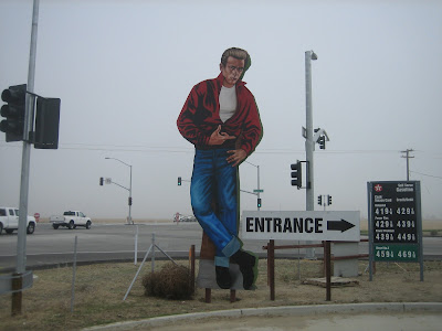
This picture's particularly good :)

Thanks. As an interesting aside, looking at all that rock, the ATK is not known for its prowess in trials competitions. :laughing It is long and heavy, perfect for screaming across dunes or stretches of desert pavement but not the most ideal stead when the sand and dirt disappear.

Understanding that, it's important to be able to move with, against, off, and around the bike in all this rock. I have tiny hard to fit feet and sport a vintage pair of kids worn out MX boots. I had them resoled recently and never considered the consequences of a lugged sole.

The bottoms of my feet kept getting stuck in the pegs and I would upset the bike terribly trying to get them unstuck.

My SO finally cut off some of the lugs but trust me, the bottoms of these boots are slated for the grinder.

11391945155_5105d24ba1_b.jpg


11392054923_d454720416_b.jpg
 
We are on our way home to Zombieland. Dread and impending doom enter our minds like wisps of smoke quickly degrading our sense of peace and well being. We have an unusual living situation that's pretty much off the grid and well below the radar but lately the zombies have attempted a re infiltration and of course without us and especially without the Bossdog home who knows what awaits us.

Deciding to opt out of reality a bit longer we exit off of 99 and head west to 33.

33 is an old highway nick named "the racer's shortcut" running North and South through California's agg lands. We stop at Blackwell's Corner (James Dean ate his last meal here) to buy a little something hopefully keeping them in business a little longer.

James+Dean+Blackwells+corner.JPG


We decide to stay on 33 to Coalinga where we will merge with the I 5 and get ourselves home.
 
At Coalinga we are torn. We want more road like 33 but continuing north won't do us much good. We look at the map and toss a coin between 198 and I5. 198 wins out and we turn left, not right, knowing that we will not be getting home anytime soon.

198 is one of those roads that breaks your heart with its beauty. We give credit to the same motorcycle loving engineer for building this road as we did for 178 and wind our way up the 7% grade :)


As we near 101 we are witness to a spectacular sunset as the moon and Venus rise.

11326517414_b26d69e524_b.jpg


With the sun down and no real reason to get home before the next day we check the GPS and determine that Santa CRuz is sort of kind of on the way :p

We find a place to park, hit the hay, and intend to wake before dawn.

The Bossdog wake us in time to catch the last of our vacation sunrises.

11326514713_0621376039_b.jpg
 
Last edited:
Back
Top