flying_hun
Adverse Selection
- Joined
- May 4, 2005
- Location
- Orinda, CA
- Moto(s)
- A funky red & white Italian named Gianni Cervo! Versys - two of 'em! And an Enfield for laughs.
- BARF perks
- AMA #: 281672
New project! Last week I put up a ride report on the visit of a couple of European buddies who came to California to ride. At the end of our ten days and almost 3K miles of riding, I told them that they had probably only ridden about 10% of the great roads California has to offer. Having made that claim, I began to wonder about all the roads that might be on the list and how many of them I have ridden, or am even aware of, and that led me to the BARF hive mind. 
After engaging with Budman and some of the mods, we decided to solicit suggestions for the list from the vast knowledge that is BARF. You may recall some years back we had a thread about what road in California is the best. This will be a little different. We're not looking to rank them, or describe them, we're only looking to catalog them. We want to capture all/as many as possible roads in California that are fun to ride on a motorcycle. That doesn't mean there are no rules, but the rules are simple.
Bud and the mod corps have a bunch of ideas about how we may use this information to plan rallies, group rides, individual recognition, etc. For now, please nominate some roads. They don't have to be long. They don't have to be paved. They only need to be fun to ride on a motorcycle. How many are there in California? From Mexico to Oregon, from the Pacific to Nevada or Arizona, what roads are worth riding? Go ahead and include roads that may currently be closed, but if you know that it's closed, please let us know.
A submission can be simple, just like what is posted immediately below, as follows:
Highway 36 from Red Bluff to Hydesville. Google Map.
We're trying to make it as simple as practicable for everyone to contribute.
Hey friends, thanks for your participation! I have a couple of requests that will make it easier to compile the list.
South Bay
San Jose Soquel Google Map
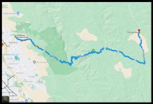
HWY 130 ~ Grab the bars and turn the mother out. CA 130, Mt Hamilton Rd to The Junction. Google Map.
East Bay
Upper Happy Valley Road (Orinda). Google Map.
Bear Creek Road (Orinda to Briones). Google Map
Pinehurst (Skyline Oakland to Redwood Road). Google Map.
North Bay
Geysers Road (Jimtown to Cloverdale, some unpaved). Google Map.
Mountain House Road (101 to 128). Google Map.
Highway 175 Hopland Grade (Hwy 29 to Hwy 101). Google Map.
Flynn Creek Road (Hwy 128 to Comptche). Google Map
Old Toll Road (Hopland Grade to Finley/Clear Lake, unpaved). Google Map
Low Gap Road (Ukiah to Comptche-Ukiah Road, unpaved). Google Map
Old Lawley Toll Rd Google map link
Cavedale Rd. Google map link
Mt Veeder Rd. Google map link
Ida Clayton Rd/Western Mine Rd. between CA128 Sonoma County and CA29 Lake County Google map link
Hwy 253, from Hwy 101 to Hwy 128. Google map.
Chalk Hill Road, Hwy 128 to Hwy 101. Google map.
Annapolis Rd, Hwy1 to Skaggs Springs Rd. Google map.
Suisun Valley/Wooden Valley Road, Cordelia to Hwy 121, paved. Google Map.
Monticello Road, Trancas Street Historic Bribge to Hey 128, paved. Google Map.
Capell Valley Road, Moscowite Corner to Turtle Rock, paved. Google Map.
Redwood Empire - north of Hwy 20
Wildwood Road from Highway 36 to Highway 3. Google Map.
Branscomb Road from Highway 101 to Highway 1. Google Map
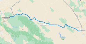
Highway 36 from Red Bluff to Hydesville. Google Map.
Weaverville—Hwy 3 to Etna to Sawyers Bar Rd to Forks of Salmon to Cecilville Road, to Callahan and back. Google Maps.
Forest Road 1, Mad River/Hwy 36 to Berry Summit/Hwy 299: Google Map
Eddy Gulch Road, Sawyers Bar to Cecilville, unpaved. Google Map
Blue Ridge Watch Tower, Sawyers Bar to Blue Ridge, unpaved. Google Map.
Eddy Gulch Lookout Road, Lafayette Point/Eddy Gulch Rd to the watch tower, unpaved. Google Map.
Huffmaster Road, Leesville Road to Sites, unpaved.Google Map.
Rail Canyon Road, Sites-Ladoga Rd to County Rte 303/Clark Valley Rd, mixed.Google Map.
Alderpoint Road, Garberville/Hwy 101 to Bridgeville/Hwy 36. Google Map.
Bell springs Road, Alderpoint Rd to Hwy 101. Google Map.
Peak Road, Alderpoint to Kettenpom. Google Map.
Zenia Lake Mountain Road, Zenia to Kettenpom. Google Map.
Zenia Bluff Road, Alderpoint to Zenia. Google Map.
Ruth-Zenia Road (County Rte 502). Google Map.
Hwy 96, Willow Creek/Hwy 299 to I-5. Google Map.
Van Duzen Road, Hwy 36 to Ruth-Zenia Road. Google Map.
Salmon River Road, Forks of Salmon to Hwy 96. Google Maps.
Mina Road, Covelo to Kettenpom, unpaved. Google Map.
Forest Highway 7/Mendocino Pass, Elk Creek to Covelo, unpaved. Google Map.
Anthony Peak Watch Tower from Mendo Pass/FH7, unpaved. Google Maps.
Forks of Salmon, North Fork, Forks to Etna. https://goo.gl/maps/HKGoKFYkiEAM97H3A
Forks of Salmon, South Fork, Forks to Callahan. https://goo.gl/maps/ng7eMYUKGDn4CnR8A
Happy Camp to Cave Junction via Greyback rd. https://goo.gl/maps/kkUeLb6Fat6jMVXT9
Hiway 1 North Coast: Leggett to Rockport https://goo.gl/maps/CbjrPUE2Q2wqUtwX6
Elk Mountain Road, Upper Lake to the Soda Creek Store, mixed/paved and dirt. Google Map.
Elk Mountain Road/Eel River Road, Soda Creek Store to Potter Valley, mixed/dirt and paved. Google Map.
Forest Route M1, Soda Creek Store to Mendocino Pass Road/Hwy 162, unpaved. Google Map.
Bartlett Springs Road, Lucern/Hwy 20 to Walker Ridge Road, unpaved. Google Map.
Walker Ridge Road, Hwy 20 to Bartlett Springs Road, unpaved. Google Map.
Bear Valley Road, Hwy 20/Hwy 16 to Leesville, unpaved. Google Map.
Platina Road, Hwy 36/Platina to Igo. Google Map.
East County Line Road, Hwy 299/Buckhorn Summit to Bully Choop Mountain Watch Tower, unpaved. Google Map.
Bully Choop Road, Platina Road/A16 to Dripping Spring, unpaved. Google Map
Stewart Springs Road/FR 42N17, Old Hwy 99 to Hwy 3. Google Map.
Gazelle Callahan Road, Old Hwy 99/Gazelle to Callahan/Hwy 3. Google Map.
Coffee Creek Road, Coffee Creek/Hwy 3 to Big Flat Campground, unpaved. Google Map.
Trinity Mountain Road/East Side Road (FR 106), Hwy 299/French Gulch to Hwy 3. Google Map.
Westside Road, Chappie-Shasta OHV area to Trinity Mountain/Eastside Road (FR 106), unpaved. Google Map
Trinity Dam Blvd, Hwy 299/Lewiston to Hwy 3. Google Map.
Ft Bragg-Sherwood Road, Willits/Hwy 101 to Ft Bragg/Hwy 1, unpaved. Google Map.
Tomki Road, East/West Road to Canyon Rd/Willits, unpaved, water crossings. Google Map.
Forest Route M3, from M10/Three Crossings to FH 7/Alder Springs, unpaved. Google Map.
Black Diamond Road, County Route 306/Stonyford to M3/Low Gap, unpaved, water crossing. Google Map.
Saint John Mountain Radio Tower Road (FR 18N06), Grey Pines Group Campground to Saint John Mountain, unpaved, high clearance 4x4 and ledgy for the last 1/4 mile—Google Maps thinks it’s a bad idea. Google Map
Plummer Lookout Road, Peanut/Hwy 3 to Plummer Peak, unpaved. Google Map.
Tule Creek Road/Limedyke Lookout Road, Hayfork to Limedyke Mountain, unpaved. Google Map.
Big Creek Rd/Hayfork Bally, Hayfork to FR 16 to the watchtower, mixed. Google Map.
Old Hwy 36/Rattlesnake/Lower Rattlesnake Road, Peanut/Hwy 3 to Hwy 36, mixed. Google Map.
Harrison Gulch/Deer Lick Knob/Deerlick Springs Road, Hwy 36 to Hwy 3, unpaved. Google Map.
Hyampom Road, Hayfork to Hyampom. Google Map.
Central Coast - south of Hwy 198
Hwy 229 (Hwy 41 to Hwy 58). Google Map
Hwy 58 (Hwy 33 to Hwy 101). Google map.
Tepusquet Road (Hwy 166 to Foxen Canyon). Google map
Foxen Canyon (Sisquoc to Los Olivos). Google map
Alisos Canyon (Foxen Canyon to Hwy 101). Google map
G14, King City to Paso Robles. Google map
Cypress Mountain Drive, Klau Mine Rd to Santa Rosa Creek Rd, unpaved. Google Map.
Santa Rosa Creek Road, Cambria/Hwy 1 to Green Valley Rd/Hwy 46. Google Map.
Old Creek Road, Cayucos/Hwy 1 to Green Valley Rd/Hwy 46. Google Map.
Coalinga-Los Gatos Creek Road, Hwy 25 to South Derrick Rd, paved. Google Map.
Preachtree/Indian Valley Road, Hwy 198/25 to San Miguel. Google Map.
Parkfield Grade/Parkfield-Coalinga Road, Parkfield Junction/Hwy 198 to Parkfield. Google Map.
Southern Sierra - South of Hwy 198
Sherman Pass, Johnsondale Bridge to Pearsonville gas station. Google Map
Hwy 168, Big Pine to Oasis. Google Map.
White Mountain Road, Cedar Flat to Locked Gate, unpaved. Google Map.
Silver Canyon Road, Laws Railroad Museum to Wyman Creek Road, unpaved. Google Map.
Wyman Creek Road, Silver Creek Road to Hwy 168, unpaved. Google Map.
Eureka Valley Road, Hwy 168 to Death Valley Road, unpaved/sand. Google Map.
Steele Pass Road, Death Valley Road to Saline Valley Warm Springs, unpaved, deep sand, high-clearance 4x4. Google Map
Casa Diablo Road, Benton Crossing Road to Laws, unpaved. Google Map
Comanche Point Road, Arvin/Hwy 223/Herron Rd. to Stallion Springs/Hwy 202/Tehachapi, unpaved. Google Map.
Titus Canyon Road, Nevada to Scotty’s Castle Road, unpaved. Google Map.
Central Sierra - between Hwy 198 and Hwy 20
Buckeye Road, Red Dog Rd to Chalk Bluff Rd, unpaved, water crossing. Google Map.
Wentworth Springs Road, Georgetown to the end. Google Map.
Ice House Road, Hwy 50 to Loon Lake. Google Map.
11 Pines Road, Wentworth Springs Rd to French Meadows Road. Google Map.
French Meadows Road, Rubicon/Ramsey Crossing Road to French Meadows Reservoir. Google Map.
Mosquito Ridge Road, Forest Hill Post Office to French Meadows Reservoir. Google Map.
Wards Ferry Road, Hwy 120/Big Oak Flat to Tuolumne Rd (Co Rd 17). Google Map.
Cherry Lake Road, Hwy 120 to Cherry Lake. Google Map.
Cottonwood Road, Cherry Lake to River Ranch campground. Google Map.
Dog Bar Road, Placer Hills Road to La Barr Meadows. Google Map.
Placer Hills Road/Tokayana Way, I-80/Clipper Gap to Coalfax. Google Map.
CA Hwy 174/Coalfax Highway, Calfax to Grass Valley. Google Map.
Brunswick Road, Cedar Crest/Hwy 174 to Glenbrook/Hwy 20/49. Google Map.
Silver Creek Road, Marine Corps Mountain Warfare Training Center to Hwy 108/Sonora Pass, unpaved. Google Map.
Burcham Flat Road, Hwy 395/Fales Hot Springs to Hwy 395/Walker, unpaved. Google Map.
Buckeye Road, Hwy 395 to Twin Lakes Road, unpaved. Google Map.
Old Stage Road, NV border/Hwy 338/Hwy 182 to Belfort to Mt Patterson, unpaved high-clearance, oh sh*t 4x4. 5636' elevation gain in 10.2 miles, or average 10% grade. Map Link.
Italian Bar Road, Columbia to Jupiter, mixed. Google Map.
Guasanillo Way - Granite Springs Rd - Blanchard Rd - Marshes Flat Rd., Hwy 132 to Hwy 49, Paved. Google Map
Old Toll Rd, Hwy 49 to Hornitos Road. Paved. Google Map
Hornitos Rd. Old Toll Rd to Merced Falls Rd. Paved. Google Map
Merced Falls Rd. Hornitos Rd to Hwy 132. Paved. Google Map
La Grange Road/J59, Snelling to Hwy 120/108, paved. Google Map.
Northern Sierra - north of Hwy 20
Highway 49 (Nevada City to Hwy 89). Google Map
Mills Peak Road, Church Meadow Rd to Mills Peak Station, unpaved. Google Map.
Gold Lake Highway, Bassett’s Station to Hwy 89/Graeagle. Google Map.
CA Hwy 49, Grass Valley to Vinson/Hwy 89. Google Map.
Ridge Road, Hwy 49 to Mountain House Road. Google Map.
Mountain House Road, Ridge Road to Goodyear’s Bar/Hwy 49, mixed, dirt/paved. Google Map.
North Bloomfield Road, Lake City to Blue Tent. Google Map.
Foote’s Crossing Road, Hwy 49/Birchfield Rd to Alleghany. mixed/gnarly 4x4 dirt. Google Map.
Surprise Valley Road, Nevada border/Hwy 447 to Oregon border, paved. Google Map.
Blue Lake Road, Menlo Baths/Co Rte 1/FR 42 to Likely/Hwy 395, unpaved. Google Map.
Butcher Ranch Road, Sierra City to Gold Lake Campground, unpaved. Google Map.
LA Region
Angeles Crest Hwy 2, La Cañada Flintridge to Wrightwood. Google Maps
Mulholland Hwy, Hwy 1 to Hwy 27/Topanga Cnyn Road. Google Maps.
Highway 33/Maricopa Hwy, Ojai to Lockwood Valley Road. Google Maps
Azusa Canyon/Glendora Mtn Road, Azusa/Hwy 39 to E Fork Road to Glendora Mtn Road/Glendora. (I have not ridden this in some time.) Google Maps
Banning-Idyllwild Panoramic Hwy, I-10 to Hwy 74. Google Map.
County Route N2 (Pine Canyon Road), Hwy 138 to Palmdale/Hwy 14. Google Map.
Comanche Point Road, Arvin/Hwy 223/Herron Rd. to Stallion Springs/Hwy 202/Tehachapi, dirt. Google Map.
SD Region
Palomar Mountain, Nate Harrison Grade/Hwy 76 to S Grade Road/Hwy 76. Google Maps
Julian, Ramona/Hwy 78 to Julian, a popular "destination" ride. Google Maps.
Highway 74, San Juan Capistrano to Lake Elsinore. Google Maps
Sunrise Highway/S1, Hwy 79 to Hwy 94. Google Map.
Mesa Grande Road, Hwy 76 to Hwy 79. Google Map.
CA Hwy 94-Campo Road, Jamacha Junction/Hwy 58 to Manzanita/I-8. Google Map.
County Route S22, Thermal/Hwy 86 to San Felipe Road. Google Map.
County Route S3-Yaqui Pass Road, Borrego Springs to Hwy 78. Google Map.
Banner-Grade/CA Hwy 78, Hwy 86 to Julian. Google Map.
Waddaya got? Post them up, we'll add them to the list. There are so many great roads, I expect the list will get huge! We plan to organize them regionally as the list grows. That will make it easier to plan trips.
After engaging with Budman and some of the mods, we decided to solicit suggestions for the list from the vast knowledge that is BARF. You may recall some years back we had a thread about what road in California is the best. This will be a little different. We're not looking to rank them, or describe them, we're only looking to catalog them. We want to capture all/as many as possible roads in California that are fun to ride on a motorcycle. That doesn't mean there are no rules, but the rules are simple.
- If you like riding a road, or even if you haven't ridden it, but you want to, put it on the list.
- If the road is a numbered state or federal highway, include the place names that bound that portion of the highway that is great for motos (e.g., Hwy 128 from Winters to Mendocino)
- Please add a link to a Google Map showing the road you're nominating (I'll put in some examples below). That will make it easier for us to catalog it, and for others to ride it.
- You don't have to describe it, or even what you like about it, but if you do, people are likely to find that information useful.
- As you nominate roads, we'll add them to the list in the first post, similar to that thread on destination restaurants.
Bud and the mod corps have a bunch of ideas about how we may use this information to plan rallies, group rides, individual recognition, etc. For now, please nominate some roads. They don't have to be long. They don't have to be paved. They only need to be fun to ride on a motorcycle. How many are there in California? From Mexico to Oregon, from the Pacific to Nevada or Arizona, what roads are worth riding? Go ahead and include roads that may currently be closed, but if you know that it's closed, please let us know.
A submission can be simple, just like what is posted immediately below, as follows:
Highway 36 from Red Bluff to Hydesville. Google Map.
We're trying to make it as simple as practicable for everyone to contribute.
Hey friends, thanks for your participation! I have a couple of requests that will make it easier to compile the list.
- If you want to post a loop, post a map for each of the component roads, to the extent that doing so is possible. In some places, you have no choice but to connect road A to road B because there is no practical alternative (e.g., Sierra to Felter). Otherwise, listing the component roads makes it easier for users to build their own routes out of those component roads.
- Don't bother associating your roads with specific rallies or destination restaurants YET. We'll do that when we have a more complete list and can see all the choices.
- If you want to wax eloquent about a road, go for it, but please lead with the road name, beginning and ending points, and Google Maps link up front so that I don't need to do a bunch of editing to get your road into the first post list.
South Bay
San Jose Soquel Google Map
HWY 130 ~ Grab the bars and turn the mother out. CA 130, Mt Hamilton Rd to The Junction. Google Map.
East Bay
Upper Happy Valley Road (Orinda). Google Map.
Bear Creek Road (Orinda to Briones). Google Map
Pinehurst (Skyline Oakland to Redwood Road). Google Map.
North Bay
Geysers Road (Jimtown to Cloverdale, some unpaved). Google Map.
Mountain House Road (101 to 128). Google Map.
Highway 175 Hopland Grade (Hwy 29 to Hwy 101). Google Map.
Flynn Creek Road (Hwy 128 to Comptche). Google Map
Old Toll Road (Hopland Grade to Finley/Clear Lake, unpaved). Google Map
Low Gap Road (Ukiah to Comptche-Ukiah Road, unpaved). Google Map
Old Lawley Toll Rd Google map link
Cavedale Rd. Google map link
Mt Veeder Rd. Google map link
Ida Clayton Rd/Western Mine Rd. between CA128 Sonoma County and CA29 Lake County Google map link
Hwy 253, from Hwy 101 to Hwy 128. Google map.
Chalk Hill Road, Hwy 128 to Hwy 101. Google map.
Annapolis Rd, Hwy1 to Skaggs Springs Rd. Google map.
Suisun Valley/Wooden Valley Road, Cordelia to Hwy 121, paved. Google Map.
Monticello Road, Trancas Street Historic Bribge to Hey 128, paved. Google Map.
Capell Valley Road, Moscowite Corner to Turtle Rock, paved. Google Map.
Redwood Empire - north of Hwy 20
Wildwood Road from Highway 36 to Highway 3. Google Map.
Branscomb Road from Highway 101 to Highway 1. Google Map
Highway 36 from Red Bluff to Hydesville. Google Map.
Weaverville—Hwy 3 to Etna to Sawyers Bar Rd to Forks of Salmon to Cecilville Road, to Callahan and back. Google Maps.
Forest Road 1, Mad River/Hwy 36 to Berry Summit/Hwy 299: Google Map
Eddy Gulch Road, Sawyers Bar to Cecilville, unpaved. Google Map
Blue Ridge Watch Tower, Sawyers Bar to Blue Ridge, unpaved. Google Map.
Eddy Gulch Lookout Road, Lafayette Point/Eddy Gulch Rd to the watch tower, unpaved. Google Map.
Huffmaster Road, Leesville Road to Sites, unpaved.Google Map.
Rail Canyon Road, Sites-Ladoga Rd to County Rte 303/Clark Valley Rd, mixed.Google Map.
Alderpoint Road, Garberville/Hwy 101 to Bridgeville/Hwy 36. Google Map.
Bell springs Road, Alderpoint Rd to Hwy 101. Google Map.
Peak Road, Alderpoint to Kettenpom. Google Map.
Zenia Lake Mountain Road, Zenia to Kettenpom. Google Map.
Zenia Bluff Road, Alderpoint to Zenia. Google Map.
Ruth-Zenia Road (County Rte 502). Google Map.
Hwy 96, Willow Creek/Hwy 299 to I-5. Google Map.
Van Duzen Road, Hwy 36 to Ruth-Zenia Road. Google Map.
Salmon River Road, Forks of Salmon to Hwy 96. Google Maps.
Mina Road, Covelo to Kettenpom, unpaved. Google Map.
Forest Highway 7/Mendocino Pass, Elk Creek to Covelo, unpaved. Google Map.
Anthony Peak Watch Tower from Mendo Pass/FH7, unpaved. Google Maps.
Forks of Salmon, North Fork, Forks to Etna. https://goo.gl/maps/HKGoKFYkiEAM97H3A
Forks of Salmon, South Fork, Forks to Callahan. https://goo.gl/maps/ng7eMYUKGDn4CnR8A
Happy Camp to Cave Junction via Greyback rd. https://goo.gl/maps/kkUeLb6Fat6jMVXT9
Hiway 1 North Coast: Leggett to Rockport https://goo.gl/maps/CbjrPUE2Q2wqUtwX6
Elk Mountain Road, Upper Lake to the Soda Creek Store, mixed/paved and dirt. Google Map.
Elk Mountain Road/Eel River Road, Soda Creek Store to Potter Valley, mixed/dirt and paved. Google Map.
Forest Route M1, Soda Creek Store to Mendocino Pass Road/Hwy 162, unpaved. Google Map.
Bartlett Springs Road, Lucern/Hwy 20 to Walker Ridge Road, unpaved. Google Map.
Walker Ridge Road, Hwy 20 to Bartlett Springs Road, unpaved. Google Map.
Bear Valley Road, Hwy 20/Hwy 16 to Leesville, unpaved. Google Map.
Platina Road, Hwy 36/Platina to Igo. Google Map.
East County Line Road, Hwy 299/Buckhorn Summit to Bully Choop Mountain Watch Tower, unpaved. Google Map.
Bully Choop Road, Platina Road/A16 to Dripping Spring, unpaved. Google Map
Stewart Springs Road/FR 42N17, Old Hwy 99 to Hwy 3. Google Map.
Gazelle Callahan Road, Old Hwy 99/Gazelle to Callahan/Hwy 3. Google Map.
Coffee Creek Road, Coffee Creek/Hwy 3 to Big Flat Campground, unpaved. Google Map.
Trinity Mountain Road/East Side Road (FR 106), Hwy 299/French Gulch to Hwy 3. Google Map.
Westside Road, Chappie-Shasta OHV area to Trinity Mountain/Eastside Road (FR 106), unpaved. Google Map
Trinity Dam Blvd, Hwy 299/Lewiston to Hwy 3. Google Map.
Ft Bragg-Sherwood Road, Willits/Hwy 101 to Ft Bragg/Hwy 1, unpaved. Google Map.
Tomki Road, East/West Road to Canyon Rd/Willits, unpaved, water crossings. Google Map.
Forest Route M3, from M10/Three Crossings to FH 7/Alder Springs, unpaved. Google Map.
Black Diamond Road, County Route 306/Stonyford to M3/Low Gap, unpaved, water crossing. Google Map.
Saint John Mountain Radio Tower Road (FR 18N06), Grey Pines Group Campground to Saint John Mountain, unpaved, high clearance 4x4 and ledgy for the last 1/4 mile—Google Maps thinks it’s a bad idea. Google Map
Plummer Lookout Road, Peanut/Hwy 3 to Plummer Peak, unpaved. Google Map.
Tule Creek Road/Limedyke Lookout Road, Hayfork to Limedyke Mountain, unpaved. Google Map.
Big Creek Rd/Hayfork Bally, Hayfork to FR 16 to the watchtower, mixed. Google Map.
Old Hwy 36/Rattlesnake/Lower Rattlesnake Road, Peanut/Hwy 3 to Hwy 36, mixed. Google Map.
Harrison Gulch/Deer Lick Knob/Deerlick Springs Road, Hwy 36 to Hwy 3, unpaved. Google Map.
Hyampom Road, Hayfork to Hyampom. Google Map.
Central Coast - south of Hwy 198
Hwy 229 (Hwy 41 to Hwy 58). Google Map
Hwy 58 (Hwy 33 to Hwy 101). Google map.
Tepusquet Road (Hwy 166 to Foxen Canyon). Google map
Foxen Canyon (Sisquoc to Los Olivos). Google map
Alisos Canyon (Foxen Canyon to Hwy 101). Google map
G14, King City to Paso Robles. Google map
Cypress Mountain Drive, Klau Mine Rd to Santa Rosa Creek Rd, unpaved. Google Map.
Santa Rosa Creek Road, Cambria/Hwy 1 to Green Valley Rd/Hwy 46. Google Map.
Old Creek Road, Cayucos/Hwy 1 to Green Valley Rd/Hwy 46. Google Map.
Coalinga-Los Gatos Creek Road, Hwy 25 to South Derrick Rd, paved. Google Map.
Preachtree/Indian Valley Road, Hwy 198/25 to San Miguel. Google Map.
Parkfield Grade/Parkfield-Coalinga Road, Parkfield Junction/Hwy 198 to Parkfield. Google Map.
Southern Sierra - South of Hwy 198
Sherman Pass, Johnsondale Bridge to Pearsonville gas station. Google Map
Hwy 168, Big Pine to Oasis. Google Map.
White Mountain Road, Cedar Flat to Locked Gate, unpaved. Google Map.
Silver Canyon Road, Laws Railroad Museum to Wyman Creek Road, unpaved. Google Map.
Wyman Creek Road, Silver Creek Road to Hwy 168, unpaved. Google Map.
Eureka Valley Road, Hwy 168 to Death Valley Road, unpaved/sand. Google Map.
Steele Pass Road, Death Valley Road to Saline Valley Warm Springs, unpaved, deep sand, high-clearance 4x4. Google Map
Casa Diablo Road, Benton Crossing Road to Laws, unpaved. Google Map
Comanche Point Road, Arvin/Hwy 223/Herron Rd. to Stallion Springs/Hwy 202/Tehachapi, unpaved. Google Map.
Titus Canyon Road, Nevada to Scotty’s Castle Road, unpaved. Google Map.
Central Sierra - between Hwy 198 and Hwy 20
Buckeye Road, Red Dog Rd to Chalk Bluff Rd, unpaved, water crossing. Google Map.
Wentworth Springs Road, Georgetown to the end. Google Map.
Ice House Road, Hwy 50 to Loon Lake. Google Map.
11 Pines Road, Wentworth Springs Rd to French Meadows Road. Google Map.
French Meadows Road, Rubicon/Ramsey Crossing Road to French Meadows Reservoir. Google Map.
Mosquito Ridge Road, Forest Hill Post Office to French Meadows Reservoir. Google Map.
Wards Ferry Road, Hwy 120/Big Oak Flat to Tuolumne Rd (Co Rd 17). Google Map.
Cherry Lake Road, Hwy 120 to Cherry Lake. Google Map.
Cottonwood Road, Cherry Lake to River Ranch campground. Google Map.
Dog Bar Road, Placer Hills Road to La Barr Meadows. Google Map.
Placer Hills Road/Tokayana Way, I-80/Clipper Gap to Coalfax. Google Map.
CA Hwy 174/Coalfax Highway, Calfax to Grass Valley. Google Map.
Brunswick Road, Cedar Crest/Hwy 174 to Glenbrook/Hwy 20/49. Google Map.
Silver Creek Road, Marine Corps Mountain Warfare Training Center to Hwy 108/Sonora Pass, unpaved. Google Map.
Burcham Flat Road, Hwy 395/Fales Hot Springs to Hwy 395/Walker, unpaved. Google Map.
Buckeye Road, Hwy 395 to Twin Lakes Road, unpaved. Google Map.
Old Stage Road, NV border/Hwy 338/Hwy 182 to Belfort to Mt Patterson, unpaved high-clearance, oh sh*t 4x4. 5636' elevation gain in 10.2 miles, or average 10% grade. Map Link.
Italian Bar Road, Columbia to Jupiter, mixed. Google Map.
Guasanillo Way - Granite Springs Rd - Blanchard Rd - Marshes Flat Rd., Hwy 132 to Hwy 49, Paved. Google Map
Old Toll Rd, Hwy 49 to Hornitos Road. Paved. Google Map
Hornitos Rd. Old Toll Rd to Merced Falls Rd. Paved. Google Map
Merced Falls Rd. Hornitos Rd to Hwy 132. Paved. Google Map
La Grange Road/J59, Snelling to Hwy 120/108, paved. Google Map.
Northern Sierra - north of Hwy 20
Highway 49 (Nevada City to Hwy 89). Google Map
Mills Peak Road, Church Meadow Rd to Mills Peak Station, unpaved. Google Map.
Gold Lake Highway, Bassett’s Station to Hwy 89/Graeagle. Google Map.
CA Hwy 49, Grass Valley to Vinson/Hwy 89. Google Map.
Ridge Road, Hwy 49 to Mountain House Road. Google Map.
Mountain House Road, Ridge Road to Goodyear’s Bar/Hwy 49, mixed, dirt/paved. Google Map.
North Bloomfield Road, Lake City to Blue Tent. Google Map.
Foote’s Crossing Road, Hwy 49/Birchfield Rd to Alleghany. mixed/gnarly 4x4 dirt. Google Map.
Surprise Valley Road, Nevada border/Hwy 447 to Oregon border, paved. Google Map.
Blue Lake Road, Menlo Baths/Co Rte 1/FR 42 to Likely/Hwy 395, unpaved. Google Map.
Butcher Ranch Road, Sierra City to Gold Lake Campground, unpaved. Google Map.
LA Region
Angeles Crest Hwy 2, La Cañada Flintridge to Wrightwood. Google Maps
Mulholland Hwy, Hwy 1 to Hwy 27/Topanga Cnyn Road. Google Maps.
Highway 33/Maricopa Hwy, Ojai to Lockwood Valley Road. Google Maps
Azusa Canyon/Glendora Mtn Road, Azusa/Hwy 39 to E Fork Road to Glendora Mtn Road/Glendora. (I have not ridden this in some time.) Google Maps
Banning-Idyllwild Panoramic Hwy, I-10 to Hwy 74. Google Map.
County Route N2 (Pine Canyon Road), Hwy 138 to Palmdale/Hwy 14. Google Map.
Comanche Point Road, Arvin/Hwy 223/Herron Rd. to Stallion Springs/Hwy 202/Tehachapi, dirt. Google Map.
SD Region
Palomar Mountain, Nate Harrison Grade/Hwy 76 to S Grade Road/Hwy 76. Google Maps
Julian, Ramona/Hwy 78 to Julian, a popular "destination" ride. Google Maps.
Highway 74, San Juan Capistrano to Lake Elsinore. Google Maps
Sunrise Highway/S1, Hwy 79 to Hwy 94. Google Map.
Mesa Grande Road, Hwy 76 to Hwy 79. Google Map.
CA Hwy 94-Campo Road, Jamacha Junction/Hwy 58 to Manzanita/I-8. Google Map.
County Route S22, Thermal/Hwy 86 to San Felipe Road. Google Map.
County Route S3-Yaqui Pass Road, Borrego Springs to Hwy 78. Google Map.
Banner-Grade/CA Hwy 78, Hwy 86 to Julian. Google Map.
Waddaya got? Post them up, we'll add them to the list. There are so many great roads, I expect the list will get huge! We plan to organize them regionally as the list grows. That will make it easier to plan trips.
Last edited by a moderator:


 arty
arty