• There has been a recent cluster of spammers accessing BARFer accounts and posting spam. To safeguard your account, please consider changing your password. It would be even better to take the additional step of enabling 2 Factor Authentication (2FA) on your BARF account. Read more here.

California Moto Roads - All Of Them

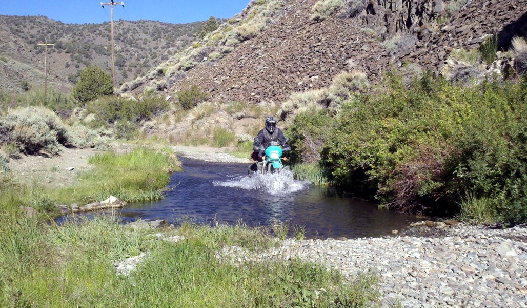
Forest Highway 7/Mendocino Pass, Elk Creek to Covelo, dirt. Google Map.

Anthony Peak Watch Tower from Mendo Pass, dirt. Google Maps.

picture.php
 
Mt Diablo ride -
Rodie's Feed & Pet Supply, 8863 Marsh Creek Rd, Clayton, CA 94517 --> Mitchel Canyon Fire Rd --> N. Gate Road --> Junction Ranger Station --> Summit Rd to the top --> Junction Ranger Station --> S. Gate Road

Google would not let me map inside park roads - https://goo.gl/maps/FE6a7UcXdjE6nDZC8

it's relatively quick and picturesque ride..

Please see the note below from the first post.

  • If you want to post a loop, post a map for each of the component roads, to the extent that doing so is possible. In some places, you have no choice but to connect road A to road B because there is no practical alternative (e.g., Sierra to Felter). Otherwise, listing the component roads makes it easier for users to build their own routes out of those component roads.

Please post individual roads rather than loops. Loops are too hard to manage in a list of this sort.

Thank you.
 
Old Lawley Toll Rd
Google map link
....
-Bill

Thanks very much, Bill. Beautiful photos. Thank you for posting the map links. If in your naming of the road, if you could name the end points, that would be very helpful. We can get that from the map too, but it would be good to see without having to open the map.

Thanks again.
 
Central coast region
Carmel Valley rd
CA25 Hollister south to 198
198 to Coalinga
CA 1 (especially when they reopen)
Santa Rosa creek rd
CA 41
Loneoak(king city to 25)
Peach tree

Thanks.

Please add endpoints, like you did for Hwy 25 and Loneoak, and map links, then I'll put them on the list.
 
So Cal Classics.

Angeles Crest...

Great stuff from the south! Thank you. While it may be possible to see it by opening the map link, it would be really helpful to post the endpoints of the part of the road you're recommending. For instance, not all of Hwy 33 is all that interesting on a moto, and it would be helpful to know what part is being recommended. For instance, Hwy 33, Ojai to 166. Google won't let us map it currrently, but we will be able to when it re-opens.
 
Thanks for all your work on this, John.

it's a lot of fun, and not much work compared to having to pull everyone's map links together and organize them! :thumbup:laughing

i'm getting geared up for my fav BARF rally which I think I've only missed once, the HoHo Weaverville rally, July 28-30--so your map link project is helping me get psyched for that trip, which may be a ten or 14 day trip because I have a rally up by Downieville the weekend before. w00t!
 
Last edited:
here's a Southern Sierras for us, with a short map link:

Sherman Pass, Johnsondale Bridge to Pearsonville gas station. Google Map.
 
Last edited:
Hwy 168, Big Pine to Oasis. Google Map.

White Mountain Road, Cedar Flat to Locked Gate, dirt. Google Map.

Silver Canyon Road, Laws Railroad Museum to Wyman Creek Road, dirt. Google Map.

Wyman Creek Road, Silver Creek Road to Hwy 168, dirt. Google Map.

Eureka Vally Road, Hwy 168 to Death Valley Road, dirt/sand. Google Map.

wyman1.jpg

Wyman Creek Road water crossing. :ride

gets kinda joke-y, what Google lets me map, and what it does not--Steele Pass Road will eat a passenger car:

Steele Pass Road, Death Valley Road to Saline Valley Warm Springs, dirt, deep sand, high-clearance 4x4. Google Map.

20140205-081922.jpg

Steele Pass Road, descending to Eureka Dunes ...

Casa Diablo Road, Benton Crossing Road to Laws, dirt. Google Map.
 
Last edited:
Mt Diablo ride -
Rodie's Feed & Pet Supply, 8863 Marsh Creek Rd, Clayton, CA 94517 --> Mitchel Canyon Fire Rd --> N. Gate Road --> Junction Ranger Station --> Summit Rd to the top --> Junction Ranger Station --> S. Gate Road

Google would not let me map inside park roads - https://goo.gl/maps/FE6a7UcXdjE6nDZC8

it's relatively quick and picturesque ride..

You are riding the fire roads on Diablo? Is this like a night time poaching deal?
 
Mt Diablo ride -
Rodie's Feed & Pet Supply, 8863 Marsh Creek Rd, Clayton, CA 94517 --> Mitchel Canyon Fire Rd --> N. Gate Road --> Junction Ranger Station --> Summit Rd to the top --> Junction Ranger Station --> S. Gate Road

Google would not let me map inside park roads - https://goo.gl/maps/FE6a7UcXdjE6nDZC8

it's relatively quick and picturesque ride..

:thumbup

one of the tricks I use when google won't route a vehicle is to click the "walking" icon. for the KLR stuff I try to map, google will often put in gaps to defeat GPS on gnarly roads ... here's your route with the "walk" icon, for some reason it only did the Diablo stuff: google walking map link.

my fav Weaverville Bally Watch Tower is like that, the road goes through but Google won't map it, even if you check the walking icon. :facepalm

Intel via PM then?! I am on Diablo a lot, the horseKarens get all huffy over bicycles- I’ve never seen a vehicle off road. Seen a couple Surron tracks and have thought about poaching it myself… but if that’s legit, I’m gonna be up there ‘splorin!
 
^^:thumbup

I'm not familiar with Mt Diablo at all, having been up there only three times--so I got nothing about any of the routes ... just knew about the google map trick to try to fill in the gaps. :angel
 
Thanks very much, Bill. Beautiful photos. Thank you for posting the map links. If in your naming of the road, if you could name the end points, that would be very helpful. We can get that from the map too, but it would be good to see without having to open the map.

Thanks again.

Edited to add end points :thumbup

Here's another:

Ida Clayton Rd/Western Mine Rd. between CA128 Sonoma County and CA29 Lake County
Google map link

Sample
DSC02555.jpg


-Bill
 
found the real short map link, finally. :facepalm

Elk Mountain Road, Upper Lake to the Soda Creek Store, paved and dirt. Google Map.

Elk Mountain Road/Eel River Road, Soda Creek Store to Potter Valley, dirt and paved. Google Map.

Forest Route M1, Soda Creek Store to Mendocino Pass Road/Hwy 162, dirt. Google Map.

picture.php

view of Mt Sanhedrin, on the left horizon, from Hull Mountain …

Bartlett Springs Road, Lucern/Hwy 20 to Walker Ridge Road, dirt. Google Map.

Walker Ridge Road, Hwy 20 to Bartlett Springs Road, dirt. Google Map.

Bear Valley Road, Hwy 20/Hwy 16 to Leesville, dirt. Google Map.
 
Last edited:
here’s a paved road for us. :facepalm:angel

Platina Road, Hwy 36/Platina to Igo. Google Map.

East County Line Road, Hwy 299/Buckhorn Summit to Bully Choop Mountain Watch Tower, dirt. Google Map.

bc.tent_.3.jpg


and the sunrise with Mt Shasta, from Bully Choop Mountain ...

you can actually get up Bully Choop Mountain via Bully Choop Road—
Google Maps just does not think it is a good idea. :laughing

Bully Choop Road, Platina Road/A16 to Dripping Spring, dirt. Google Map.
 
Last edited:
Back
Top