The goal of this ride was to explore some of the roads at the end of 377 that had gates across them until recently. I was just up there on Friday, feeling the need to do some exploring.
This is where 377 starts, down by Arrowrock Reservoir.
This is the forest service map, showing the region to explore. Anything marked in orange is what I've already ridden. Okay, before and after photos. Everything out to Highway 21 is new today.
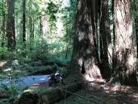
The first road was 202B, which I rode to the end, slightly past where the map showed that it ended. As you can see from the condition of the road, they get very little traffic through here.
End of the road.
Actually, somebody on a serious dirt bike could go further. I looked at it and decided it would be a bad idea to try taking an adventure bike through this little "ravine", which would have been coming from left to right getting across. If I didn't make it, I would have a difficult time getting the bike out of there.
After coming back out I headed up 202C a little ways. It was a bit steep and I decided not worth going to the end. Next was 202. I could have gotten past this tree blocking most of the road, but decided, once again, that it was a good point to turn around.
Coming back out all the way to where I first entered, the next plan was to see if 240 and 240B went all the way out. This is where 240 becomes 240B. Not a bad road at all up along the ridge.
After riding a long ways, I came around a corner and saw roads and buildings down below. I was sure it would come out at the main road at this point.
This is where it comes out at Highway 21. I never would have guessed that you could get all the way up into the hills from here.