• There has been a recent cluster of spammers accessing BARFer accounts and posting spam. To safeguard your account, please consider changing your password. It would be even better to take the additional step of enabling 2 Factor Authentication (2FA) on your BARF account. Read more here.

Photos of your bike on location

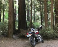
Decided to see a little bit of Oregon this trip.

Headed down into Succor Creek.
ksxetoL.jpg


Down along Succor Creek.
lzEkoNa.jpg


Back out at the turnoff for Leslie Gulch.
PBPlBjv.jpg


Headed down into Leslie Gulch.
ypNDyza.jpg


End of the road, past Leslie Gulch at Owyhee Reservoir.
mHDT8rk.jpg


Owyhee Reservoir - Boat Launch.
xdpRmAu.jpg
 
Mt Hamilton Rd

It looked like a ski resort at the end of the season, dry and bleak. The ashes looked like remnants of snow. A lot of trees were cut down and brushed were cleared so the road has a much more open view. A bunch of PG&E crews were on the road, mostly near the top.

HHNQ1G7.jpg


qS1NeAN.jpg


SazJtEq.jpg


HKcKPr0.jpg


N2pIJpk.jpg
 
Last edited:
Nothing burned here,

I have noticed that it seems that behind every big tree has sign that the Charmin Bears have visited.
One has to hike in at least 50 yards from the road to be free of this blight.
Is it "they think it is a sign of wealth and prosperity" not using nature's poison oak leaves?
Another point, Safeway has had another run on TP here in Fortuna.
I believe Colbert mentioned something about another run on TP this week, with flu/covid season "returning" this fall?
Panic buying, or,
Dusty heavy grass fire trucks are in town, fire crews restocking during our "rain event" yesterday.

or,

another symptom of "closed restrooms" ?
 

Attachments

  • IMG_2727.jpg
    IMG_2727.jpg
    182.4 KB · Views: 33
Hemmingway Butte OHV Park staging area. I was on the CRF230.
lpsQNJY.jpg


This was the turn-around point. I was getting out of my comfort zone in a few spots and it's supposed to get trickier further along, so we turned around and found a few other trails back to the truck. Although possible to ride this stuff on either of my two bikes, it would not have been any fun. It was a lot of sand, rocks, and whoops.
zJi3FaT.jpg
 
Pearl Rd between Eagle and Horseshoe Bend, at the highest point.
4KOPqdf.jpg


Harris Creek Rd at the highest point where Boise Ridge Rd splits off.
TXzvZPP.jpg


Pine Creek Rd at one of the good scenery viewing spots.
AqSrP00.jpg
 
Feather River Canyon day trip. (A week before the fires) 90° turns into a hail storm quickly in the Sierra.

510 miles roundtrip.
 

Attachments

  • Screenshot_20200924-193429_Gallery.jpg
    Screenshot_20200924-193429_Gallery.jpg
    100.4 KB · Views: 33
  • Screenshot_20200924-193441_Gallery.jpg
    Screenshot_20200924-193441_Gallery.jpg
    66.8 KB · Views: 31
  • Screenshot_20200924-193711_Gallery.jpg
    Screenshot_20200924-193711_Gallery.jpg
    85.8 KB · Views: 34
China Grade

QVvi0DY.jpg


236

e0p1dFN.jpg


Taungpulu Monastery

A1wVSSN.jpg


sV5VFrN.jpg


Empire Grade

PhK9OCO.jpg


Ben Lomond

TUvAENk.jpg
 
Back
Top