• There has been a recent cluster of spammers accessing BARFer accounts and posting spam. To safeguard your account, please consider changing your password. It would be even better to take the additional step of enabling 2 Factor Authentication (2FA) on your BARF account. Read more here.

Photos of your bike on location

Summit Rd @ Hwy 17

37435000805_9ff56a19f0_b.jpg


37435000015_9b8bb7f74d_b.jpg


Hwy 1, south of Carmel

37434998735_ab34af799f_b.jpg


37434999185_ddf5421e22_b.jpg


37434998185_858edd79ae_b.jpg


37434997625_48883a8340_b.jpg


37434997125_ec96df0c1f_b.jpg
 
Last edited:
Nacimiento-Fergusson Rd

37292396681_edc8c0fb85_b.jpg


37434996405_cc732b19c6_b.jpg


37434995625_153cdf56cf_b.jpg


37292393941_7576567491_b.jpg


36591600734_3384f26818_b.jpg


37253947736_59e6af1e02_b.jpg


Lockwood-Ardo Rd

37301178821_595a8fda3b_b.jpg


Lockwood-San Lucas Rd

36591602764_b404059285_b.jpg
 
Last edited:
That doesn't even look real! :wow
I know it is because I've been there, but…damn!!


WC

The unreal part is that in my younger years I've been to the top of every peak and needle in this picture to the south of Whitney. Climbed the face of Keeler Needle, been up the mountaineer's route mid-winter and spent a night on the top of Whitney in the summer. :teeth The last time I was up there was literally 27 years ago. :afm199

But here's another "on location" shot. This one is from teh Tumble Inn on the Ridge Route above the Grapevine.

2016_1006_11024100-XL.jpg
 
Last edited:
So speaking of Alabama Hills...

A few years ago we go do a three day ride around Death Valley and we trucked down and spent the night before departure camping in Alabama Hills

X457BsP6m9JZ3FWnJHVetFZYxLP83doOzbDk495EVa3cK8YM0tkNtfPNG50dQGyoCFSW26Fap2URmetY0ZPcjvVlyq5UhWbHfuL_S3PFJbPr-0-DWFxlNKxkZN3jwkkoD_hj8dw3I8S1E4qfeTXW2O-6z0fGG7h7kgYvxp6RFA5Jl10lHjfHzcgPtYIOE_Z_s-Y0-DnTlAaZg-KppL6y7gO0NsopGmnkJiDeBF7MjISlMtHaBsnU6WWt8UbPLJHdBKenYm36TL-TDCc-mQ7X2Hdd5TFp1oC4rOJUhiyYW_zeCHt1HQozZKFZ6QzKZkYTo6mzzMHvEedu-J2Chja57VGD22QuXwl20vkC88YIzU_XGcnFe5KxqRkYUP2sVNtzyn2TOxFIykY-jyHF6vYjTT74_tNwVpeiIhxweaGEVNDjtJJJgvYNj5uJzcKkeShEYvAExXgTyue-sPqz7pleHZufhTa-M8JnuW00eJndiDNoV2oUBNMbdc5e5oyIzPDG1HTDJqlbYcbek5REacKjbzgomRoOu5Wurr-9vuvAKYgC3sOSXD5xMa2DS-U91MNBSYK5NA9RK3gcXbSN5BCiwxUI_o34XEn4B2fd-F6iR4A5DZcV=w1024


About a month later I'm watching Django Unchained

Kd92qJsmq0k6CNqmX4TVz6YKEj3NyskmDxiTYHPgD8fcE_CdVQ_BYm07IOHRNo3g3EGIrSVUC-DSlO_MuYtcducEg7JZx30PNXSCHYwIubDlRBIwQl7J5xJKMiQHnPZ3euUfUUn-IhI1fv7-TNOekRPzqIzeOL_dNyWFfTWnUEfuJ93Ps8MQI9acsk0r4z2K8FgnZvXvA4cE_bKi7zhS2DnnuWF1-WuZ305cDnLAdY_S4_TmpjyeBkcXl9ANZsmimQAkVLNTxTuunrNBJsAhlQyXlL_krbOoIHYDG2YTDBl7iyZL7PjdWnfYgRXgg5WY6qElpkBm382VaHgqeptbr-ajT6hPCm3hIRfhnnB_DqNUqgTePBTjEYGFuHmWabnA_InphYdc-kSilJa5EMV4JS1eSwq_niJ_nUGoO3QcgjCgNRpX18a-_5Drp4v2kjMrnDohzwxGqZRI1h3rZDMm1ZS4S5WlT7cJLUuqn0ktQVsz2a3p9ACSidU6I3kLhiv5SfU6FUIZi5WlTKWJQnwan8vOOKfM0h5Euy-mGh5LZivgLjOlcN36CQZxO95qffnLNBU1NPxjJ_UGQrBEsrP42WKonzuY77isPWNn67L1-SYzc_nY=w1024


If you look closely you can see that even the fire ring we are using is the one from the movie.

This is a bike on location thread, so here is my 500EXC in the vicinity of Sand Mountain in NV...

MzA0KN8_rXdFIyo7POv_Oc0_Es_oHvhv0kAhbg8Btql8kuBKip0xBWl1MyrM11WAXtwYNPh1nhRP9We480xaL9TIt-d5utnOAWzx92Hc2kJUQQwpDDU05a6euOobUSxTZRf_0RvxDOQQ-Tug0pflg8DTDeeVeV0riysyUG10y0rOmopTmFf5DuvASP8ITppeyl-IgoOjw1v2jO_n4ebGXGP4ipGYs1v3vHFxBSJZJNi_eP3CwF7j7o1qM6gDOs5b23qpRnKyoxgN6ihCuJlKDCGmb30csFWofwXkDr3cKl98VHVcCiY5J2cwKjrDHz6dOttqv5UROxgAsBzVFZJCOh--Qb4_g_DJ0NNSeqHad0kpfOG99QXd-gbi7Zm4Wcv0v2NXuWNJA_-d6FfjR4jusfdQyrtLlbo-K2pAId63ZVWFMKD7nOg5wL1cPz2A-HXyqijqxtSgv7GXnPX8_mwsJbDyGNCSYE08pt2tvPnWPumVynSabcyK4ZPVe12333JUjQQWgY41uGEOloTIckMNm1teTxKqHUI4j6G4v_pVY1hQJTSL7lx5R05quEVQLSdQqy9ytI0kKYXIxBrf_68bMirk7iaFPf-oj-Oik6oBm2g7o0hO=w1024
 
But here's another "on location" shot. This one is from teh Tumble Inn on the Ridge Route above the Grapevine.

Is the Ridge Route open any more? I thought it was closed.

I rode it once coming back from a rec.moto Joust when we visited Edwards.
 
Is the Ridge Route open any more? I thought it was closed.

I rode it once coming back from a rec.moto Joust when we visited Edwards.

Technically, no. It's got gates across it and you can go as far as the Tumble Inn from the north. Unless you have the right key.
 
The fake depth of field thing on the new iPhone 7 Plus works surprisingly well sometimes.

30151440334_0d404f2ddb_b.jpg


30147105183_55820f61e4_b.jpg
 
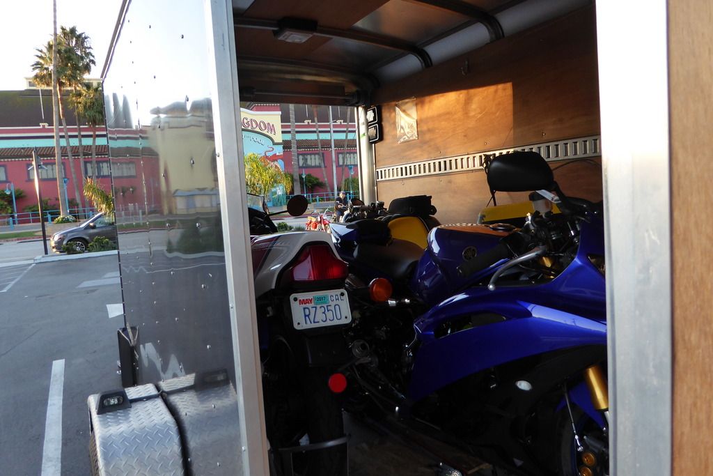
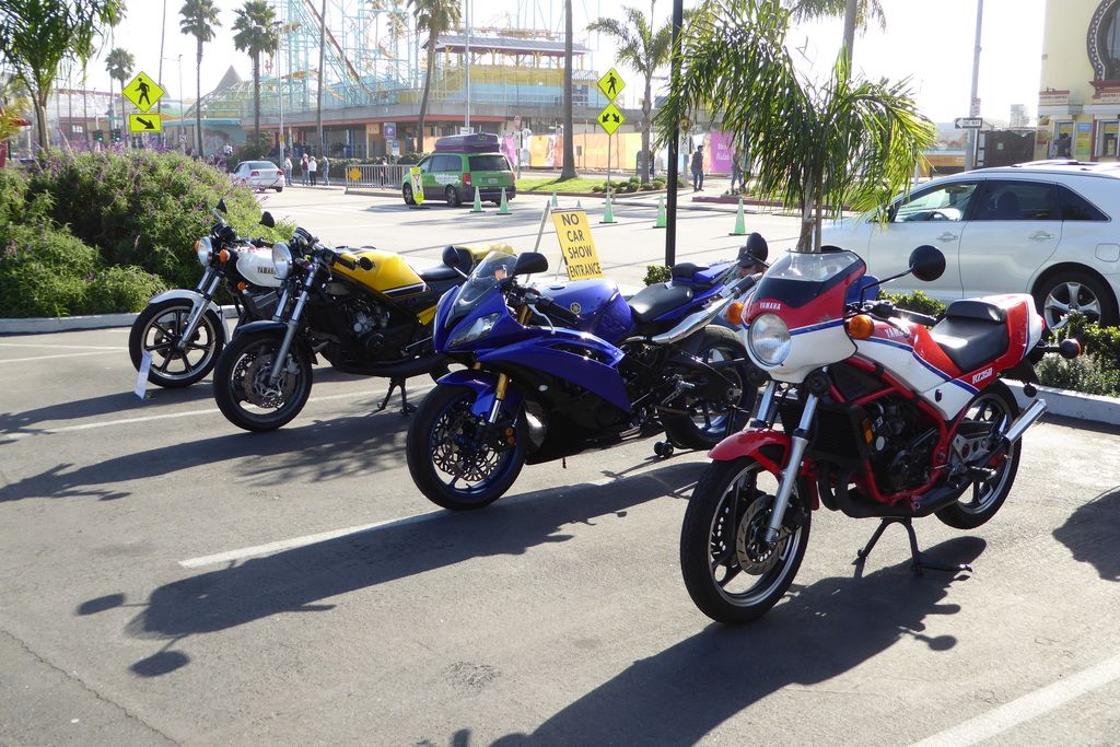
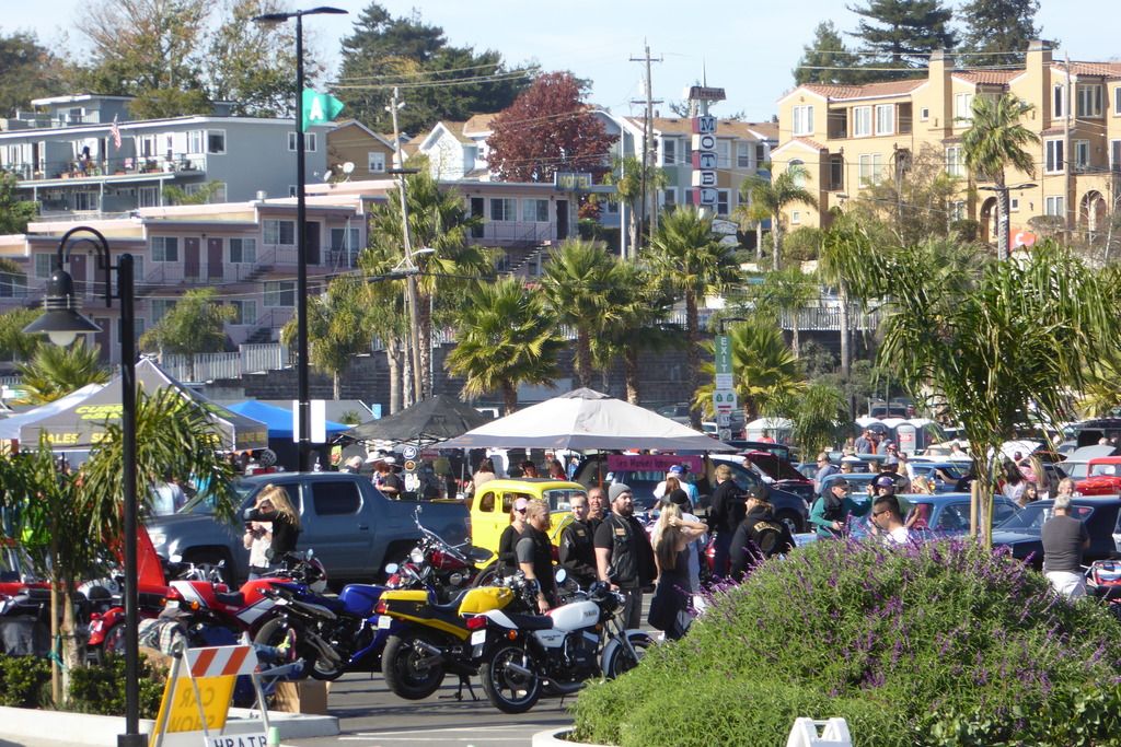
Hot Rods at the Beach in Santa Cruz.

The weather could not have been better for a mostly car and a few bikes show.


The Daytona is John's a Santa Cruz resident. We have been on a couple of vintage bike rides together. It was great to see him again.


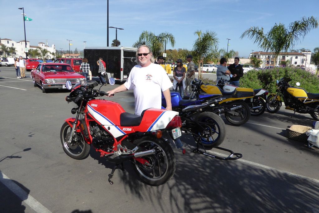
Here is an interesting little tidbit. This is my bike but it ain't me. The dude posing there walked by at the show and recognized the bike. He purchased the bike new in 1983 and had it imported from Canada. He bought the personalized plate that is on it. It was pretty cool meeting him and getting his 20+ year ownership history on the bike. I bought it from the guy that bought it from him.

 
Petaluma, only a couple of blocks from downtown. I love weathered industrial warehouses with broken window panes - modern version of Dracula's castle.

37264711052_007495dbef_b.jpg


36624213153_a77a126bff_b.jpg


Hwy 1, Jenner. A very dramatic spot; panoramic view with lots of slow moving things unfolding in the distance - surfs and sea sprays, low-flying birds, kayakers, beach combers...

37264710222_fec4e09d30_b.jpg


37247034086_27a9447ce7_b.jpg


37264709362_dd6557ff63_b.jpg
 
Last edited:
Meyers Grade

37264708872_a6f5cf313d_b.jpg


King Ridge Rd. First time, awesome, my new favorite.

37247032396_b7f59fd6b6_b.jpg


37247031506_b795faff87_b.jpg


37264706952_578d133db7_b.jpg


37247028476_4d72cee237_b.jpg


37247027726_d7f5d95d14_b.jpg
 
Last edited:

The unreal part is that in my younger years I've been to the top of every peak and needle in this picture to the south of Whitney. Climbed the face of Keeler Needle, been up the mountaineer's route mid-winter and spent a night on the top of Whitney in the summer. :teeth The last time I was up there was literally 27 years ago. :afm199

Fun fact it has gotten taller since then:p
 
Hwy 1, south of Stewart Point.

37247026596_49853a47de_b.jpg


37247025566_cc0c2c74b2_b.jpg


Kruse Ranch Rd. Moist dirt, not dusty, not slippery - perfect.

37247024766_df5cef3046_b.jpg


Hauser Bridge Rd

37436496715_b47cb53402_b.jpg


Hwy 1, north of Jenner

37247023286_6a32860f40_b.jpg
 
Last edited:
King Ridge Rd. First time, awesome, my new favorite.

IMG_0980_zpszgin5n44.jpg


One of my favorites, too, and you've captured it beautifully!
Thank you for always posting such fantastic photos :)


WoodsChick
 
Here is a shot of my bike on top of the Manic-5 dam in Quebec, immediately following hundreds of miles of muddy Trans-Labrador Highway:

Photo%20Sep%2020%2C%209%2030%2027%20AM%20(1).jpg
 
Last edited:
Back
Top