- Joined
- Apr 4, 2002
- Location
- Menlo Park, Ca.
- Moto(s)
- Keep me rocking life
- Name
- Budman
- BARF perks
- AMA Life Member #203453
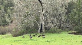
Thought I'd share this cool pic I took at Knoxville BLM area a few weeks ago.
Nice shot!

Thought I'd share this cool pic I took at Knoxville BLM area a few weeks ago.


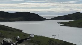
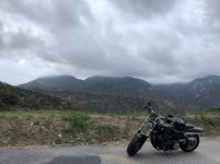
Went down the coast this morning around 11... very light traffic, everywhere, but there was a couple of road crews here and there.
The view was spectacular, from Hurricane Point I could see north of Santa Cruz.


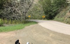
I had heard that there is a road that goes down to the Snake River about half way between the
two places where I know you can cross the river. Decided to see if I could find the route.
This road ended at the top of a cliff, where the power lines cross the river.
Same parking spot looking back upstream.
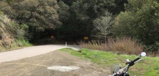
Found the route that I know goes down to the river, based on Google Maps images from outer
space. It's going to be "fun" coming back up this trail. I actually manage to dump the thing
somewhere around here.
Stopped on the way down to let about 15 psi out of the tires for better traction. This is
very close to where my new bike got its first battle scar on the way back out.
Down by the river, at the end of the road that goes for a mile or two along the water.
Found the route that I know goes down to the river, based on Google Maps images from outer space. It's going to be "fun" coming back up this trail. I actually manage to dump the thing
somewhere around here.


Most of the places that I want to ride still have snow on them. Gotta explore the lower elevations. I'll go back to that road on my XR650L one of these days and see if it's any easier.That looks way too hard for me to even want to attempt on my own ADV bike. Someone else's bike, maybe.