-
There has been a recent cluster of spammers accessing BARFer accounts and posting spam. To safeguard your account, please consider changing your password. It would be even better to take the additional step of enabling 2 Factor Authentication (2FA) on your BARF account. Read more here.
You are using an out of date browser. It may not display this or other websites correctly.
You should upgrade or use an alternative browser.
You should upgrade or use an alternative browser.
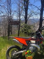
Photos of your bike on location
- Thread starter Gary856
- Start date


doc4216
Coastie who high fives
- Joined
- Aug 24, 2014
- Location
- The Land of Cle
- Moto(s)
- 2016 R1200RS
- Name
- Shannon
- BARF perks
- AMA #3289553
From this morning's ride to the SF National Cemetery

thePUNISHER
RAMPAAAAAAGE!
- Joined
- Feb 25, 2008
- Location
- Merced
- Moto(s)
- Looking for a new one! RIP Hyper!
- Name
- Keith
- BARF perks
- AMA #3495698
Figured I better get a ride in today before the big heat wave hits this week. Hope everyone is having a great, safe Memorial Day.


Lonster
GaMMa RaNGeR
- Joined
- Jan 21, 2003
- Location
- The Emerald Triangle
- Moto(s)
- 1986 RG500 Gamma, 2020 KTM 890 Duke R, 1975 RD400 AHRMA Special, 1975 CB350f
- Name
- Lonster
- BARF perks
- AMA #: 305491
who is that character on the left?
D-bag...wait, i mean dtrides. (Duncan)
Johndicezx9
Rolls with it...
ichabodnt650
AAA maps and DSLR
Adobe Springs

ichabodnt650
AAA maps and DSLR
Hwy 49 south of Coulterville

SVsick50
Well-known member
San Jose
These are some of the most dystopian pictures I have seen of San Jose. Eerie when you add the murals and sculptures of children and development, juxtaposed with graffiti, extreme homelessness, drug addiction, trash and decomposition.
A++ Gary!!!!!
WoodsChick
I Don't Do GPS
- Joined
- Jan 25, 2005
- Location
- Oakland
- Moto(s)
- GasGas EP280, CR125, Husky WR165, 2 SM610's, 1 TE610, 3 TR650's, FZR400/600, GSXR750, KTM 450EXC
- BARF perks
- AMA #: 489282

ScottRNelson
Mr. Dual Sport Rider
On the way up to Silver City, looking back toward civilization.

The highest point on the road headed to Silver City.

They need to cross out "welcome" on their sign. They're making sure only locals can come any further. And it makes sense, because there's nowhere to go beyond this point and the town has no services at all.

On the way out I spotted a road I've never been on. "I wonder where that goes?"
According to Garmin I should be able to follow it all the way to Jordan Valley. But not when riding alone with mud and snow still along the road. Garmin says it's "Flint Creek Rd" but the road signs say "Road 483". I'll have to come back and find out what's at the other end of this road.

The highest point on the road headed to Silver City.
They need to cross out "welcome" on their sign. They're making sure only locals can come any further. And it makes sense, because there's nowhere to go beyond this point and the town has no services at all.
On the way out I spotted a road I've never been on. "I wonder where that goes?"
According to Garmin I should be able to follow it all the way to Jordan Valley. But not when riding alone with mud and snow still along the road. Garmin says it's "Flint Creek Rd" but the road signs say "Road 483". I'll have to come back and find out what's at the other end of this road.
- Joined
- Apr 4, 2002
- Location
- Menlo Park, Ca.
- Moto(s)
- Keep me rocking life
- Name
- Budman
- BARF perks
- AMA Life Member #203453
WoodsChick
I Don't Do GPS
- Joined
- Jan 25, 2005
- Location
- Oakland
- Moto(s)
- GasGas EP280, CR125, Husky WR165, 2 SM610's, 1 TE610, 3 TR650's, FZR400/600, GSXR750, KTM 450EXC
- BARF perks
- AMA #: 489282
You got out!!
I did!
 arty
artyI felt like a law-breakin' hooligan the entire time due to not receiving my tags/registration from DMV yet, but we didn't see anyone out and about on either of the days so it was all good! I love riding out of our place down there, and I love me a Husky 610 like no other

WoodsChick
I Don't Do GPS
- Joined
- Jan 25, 2005
- Location
- Oakland
- Moto(s)
- GasGas EP280, CR125, Husky WR165, 2 SM610's, 1 TE610, 3 TR650's, FZR400/600, GSXR750, KTM 450EXC
- BARF perks
- AMA #: 489282
On the way out I spotted a road I've never been on. "I wonder where that goes?"
According to Garmin I should be able to follow it all the way to Jordan Valley. But not when riding alone with mud and snow still along the road. Garmin says it's "Flint Creek Rd" but the road signs say "Road 483". I'll have to come back and find out what's at the other end of this road.
What road were you on when you saw the 483 sign? Looks like there's a ghost town of Flint, and a cemetery! Double bonus!
ScottRNelson
Mr. Dual Sport Rider
Apparently Flint is at the other end. I was closer to Silver City.What road were you on when you saw the 483 sign? Looks like there's a ghost town of Flint, and a cemetery! Double bonus!
I only went as far as what this map shows as War Eagle Mountain.
WoodsChick
I Don't Do GPS
- Joined
- Jan 25, 2005
- Location
- Oakland
- Moto(s)
- GasGas EP280, CR125, Husky WR165, 2 SM610's, 1 TE610, 3 TR650's, FZR400/600, GSXR750, KTM 450EXC
- BARF perks
- AMA #: 489282
Apparently Flint is at the other end. I was closer to Silver City.
I only went as far as what this map shows as War Eagle Mountain.
Ahh...got it. Looks like on my map that if you headed south on that little white line out of Silver City that you could probably make it down to Flint on a regular dirt bike. Maybe
 Would be fun to try!
KooLaid
Hippocritapotamus
thePUNISHER
RAMPAAAAAAGE!
- Joined
- Feb 25, 2008
- Location
- Merced
- Moto(s)
- Looking for a new one! RIP Hyper!
- Name
- Keith
- BARF perks
- AMA #3495698
Hwy 49 south of Coulterville
Hey I was just up there this morning!
Gotta get out early in the day to beat the heat. It was just about this time in the ride I noticed my back tire was starting to show a cord or 2. Won't be able to take her out again until I get a new Rosso 3 put on there..


Blankpage
alien
Test rode new Hyper, anti wheelie doesn't work

Johndicezx9
Rolls with it...
Naughty-naughty!